
Make the call
See the conditions and warnings that change a departure decision.

Make faster, better-informed flight decisions from the airport surface to the weather along your route.
Know what is changing, which runway is usable, where the hazards are, and what deserves a closer look before departure.
Built around the flight decision
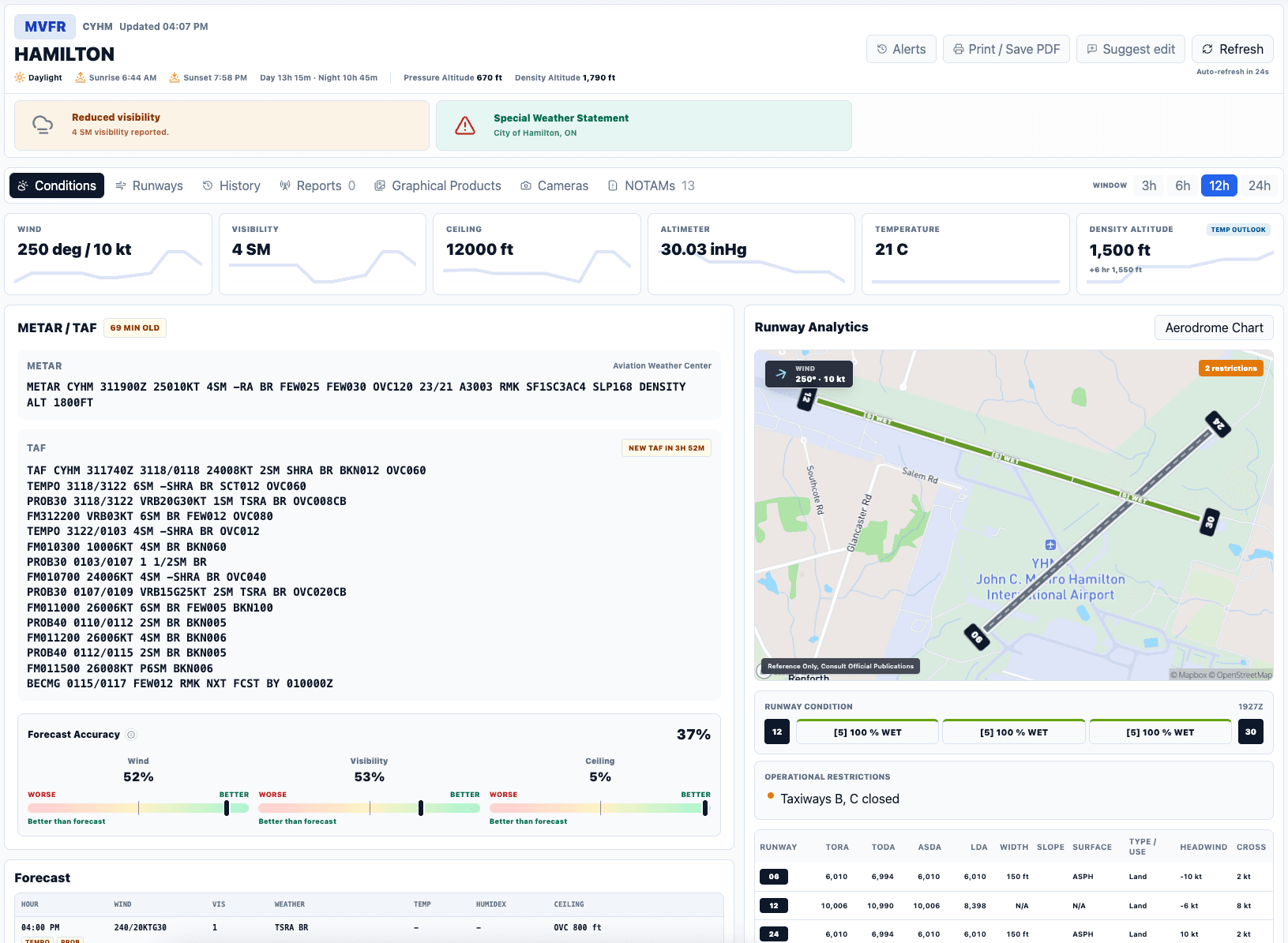
AeroOps turns official weather and aerodrome information into answers: what is changing, which runway is usable, where the hazards are, and what deserves a second look before departure.
See the conditions and warnings that change a departure decision.
Compare wind, surface condition, distance, and restrictions together.
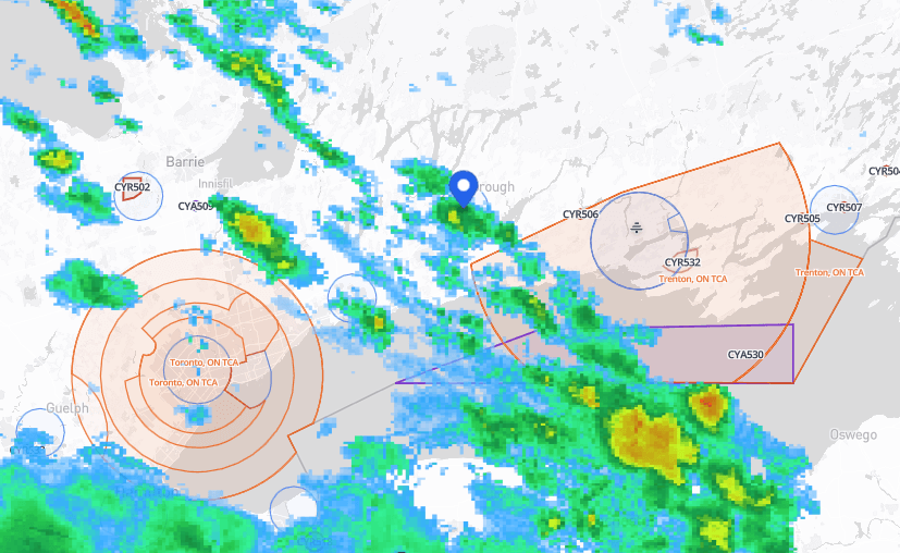
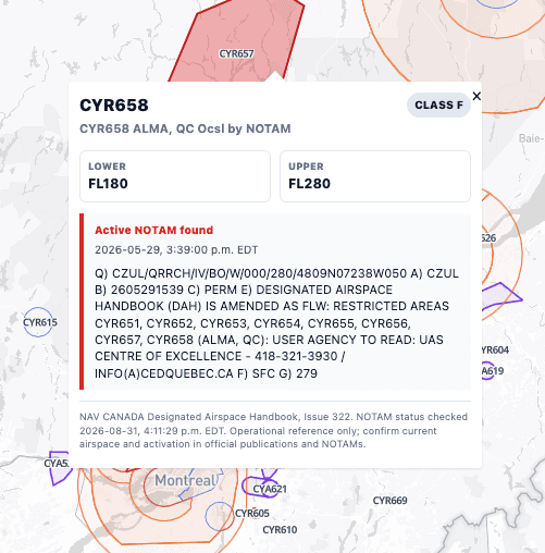
Place precipitation, airspace, and NOTAMs in geographic context.
Understand how forecast weather may evolve over the flight window.
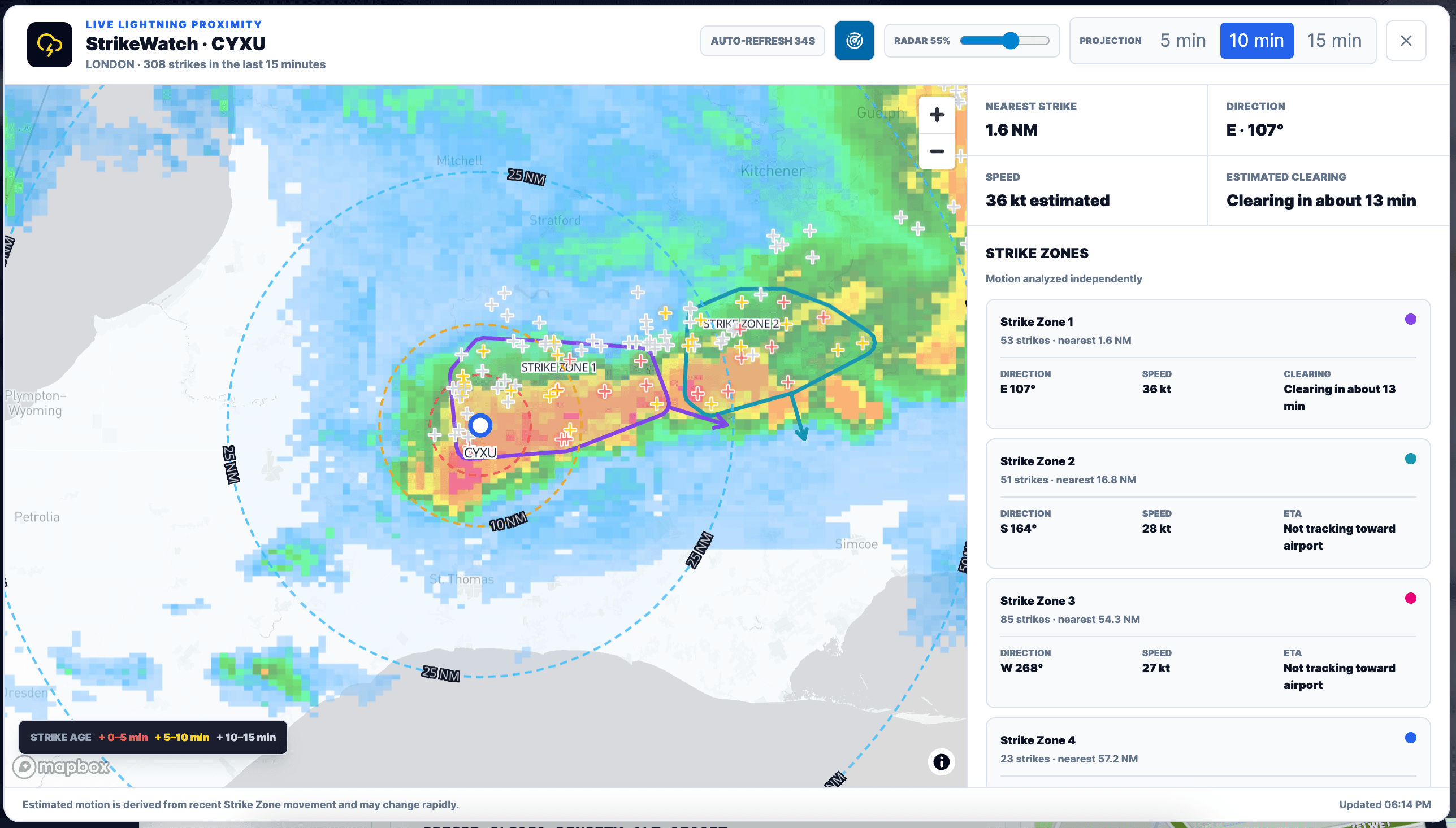
StrikeWatch turns recent lightning into distinct Strike Zones, then checks their movement against the latest radar history. See proximity rings, estimated direction and speed, airport arrival or clearing time, and the individual strikes behind the analysis.
When strikes move near an airport, AeroOps enhances airport monitoring and refreshes lightning intelligence more frequently.
Motion and timing are estimates for situational awareness. Always verify current weather with official sources.
Runway decisions
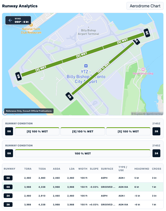
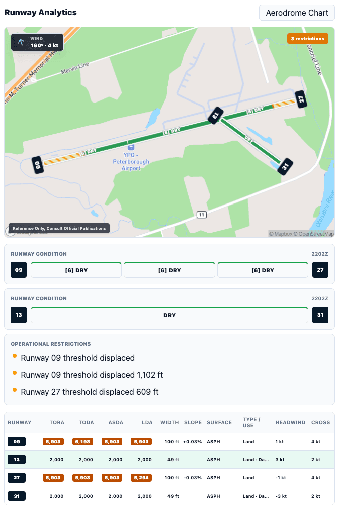
A runway number alone is not enough. AeroOps connects the wind to the pavement, then adds surface condition, declared distances, displaced thresholds, closures, and operational limitations.
Route awareness
Weather becomes operational when it is placed against the route, controlled and special-use airspace, and active NOTAM areas. AeroOps helps expose the interaction before it becomes an in-flight surprise.
Weather evolution
Compare current and future graphical forecasts, animate radar history, and examine precipitation type and echo tops so timing and trend become part of the plan.
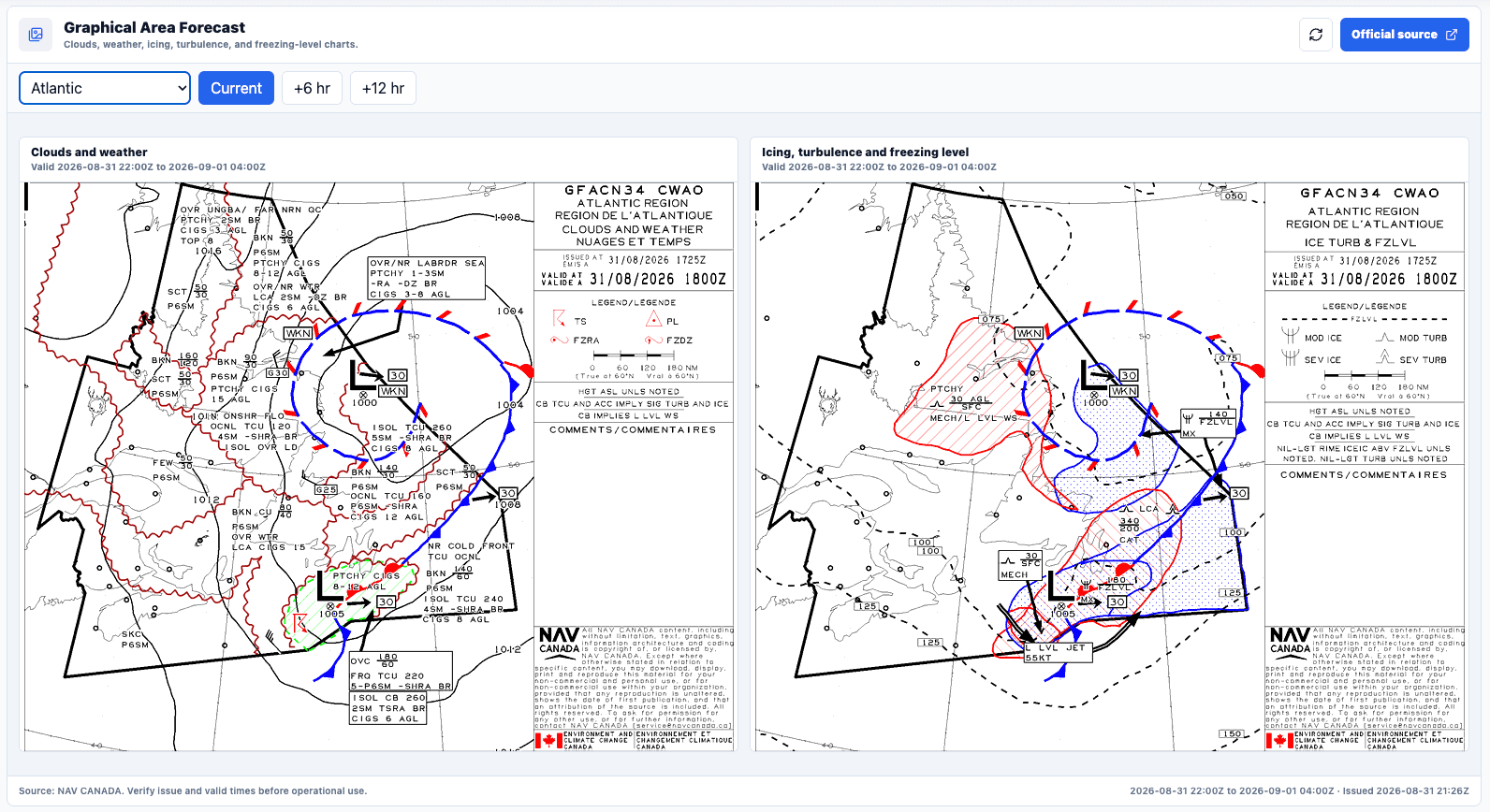
Use clouds, weather, icing, turbulence, and freezing-level products to understand the broader environment around the route.
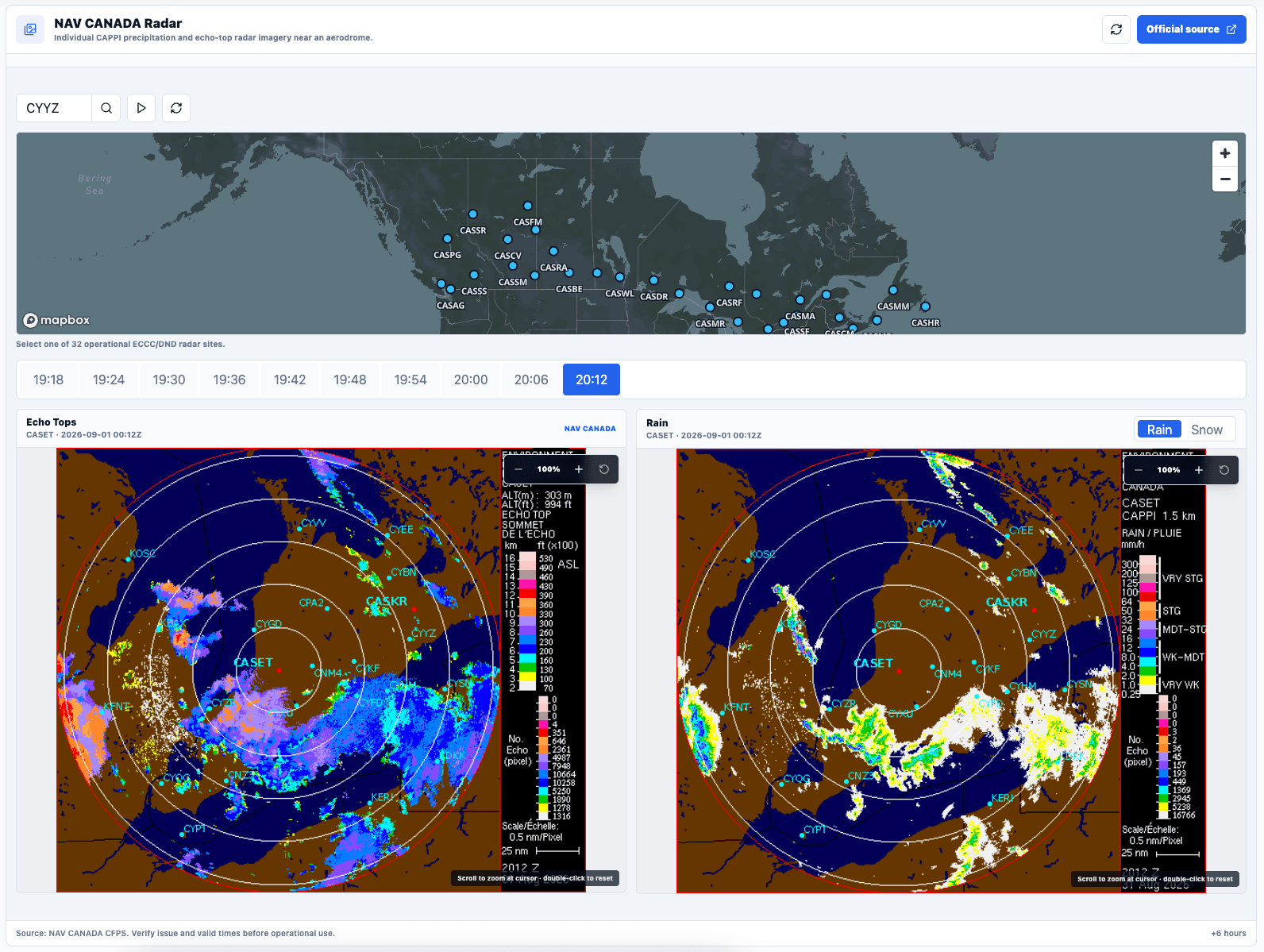
Track where precipitation is moving and distinguish intensity, precipitation type, and vertical development near the intended operation.
Forecast confidence
AeroOps compares recent forecasts with what actually occurred, helping you see whether wind, visibility, and ceiling guidance has been dependable—and whether a nearby forecast supports the same picture.

Simple Weather subscription
Start with complete AeroOps Weather access. Your first $5 CAD monthly charge begins after the seven-day trial ends.
Start the 7-day free trialCancel before the trial ends to avoid a charge.
$5 CAD
per month after trial
7 days
full access at no charge
Cancel anytime
no long-term commitment
Weather is available now.